 vesseltracker.com
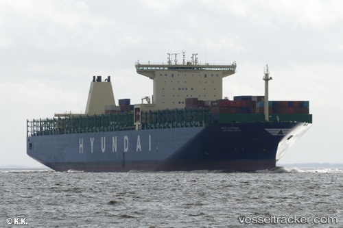
Vessel HYUNDAI DRIVE IMO: 9637246, MMSI: 440009000 Container Ship
UTC, 48.52813, -127.58468, course: 95, speed: 12.6
UTC, 48.50190, -127.10660, course: 93, speed: 12.5
2026-03-05 17:41:20 UTC, 48.49170, -126.43180, course: 91, speed: 12.8
Live Vessel HYUNDAI DRIVE Analytics (details, animations, etc.)
Live AIS position: UTC. 44 nm SW of UCLUELET), updated 2026-03-05 17:41:20 UTC.Find the position of the vessel HYUNDAI DRIVE on the map. The latter are known coordinates and path.
marine traffic ship tracker show on live map
The current position of vessel HYUNDAI DRIVE is 48.49170 lat / -126.43180 lng. Updated: 2026-03-05 17:41:20 UTCCurrently sailing under the flag of Korea (Republic of)
HYUNDAI DRIVE built in 2014 year
Deadweight:
145980 tDetails:
Last coordinates of the vessel:
UTC, 48.55877, -128.34242, course: 92, speed: 12.8UTC, 48.52813, -127.58468, course: 95, speed: 12.6
UTC, 48.50190, -127.10660, course: 93, speed: 12.5
2026-03-05 17:41:20 UTC, 48.49170, -126.43180, course: 91, speed: 12.8